- Period
- 1949-1950s
- Distance
- 35 min by tram from the Rynek
Plac Centralny and the idea of an ideal town
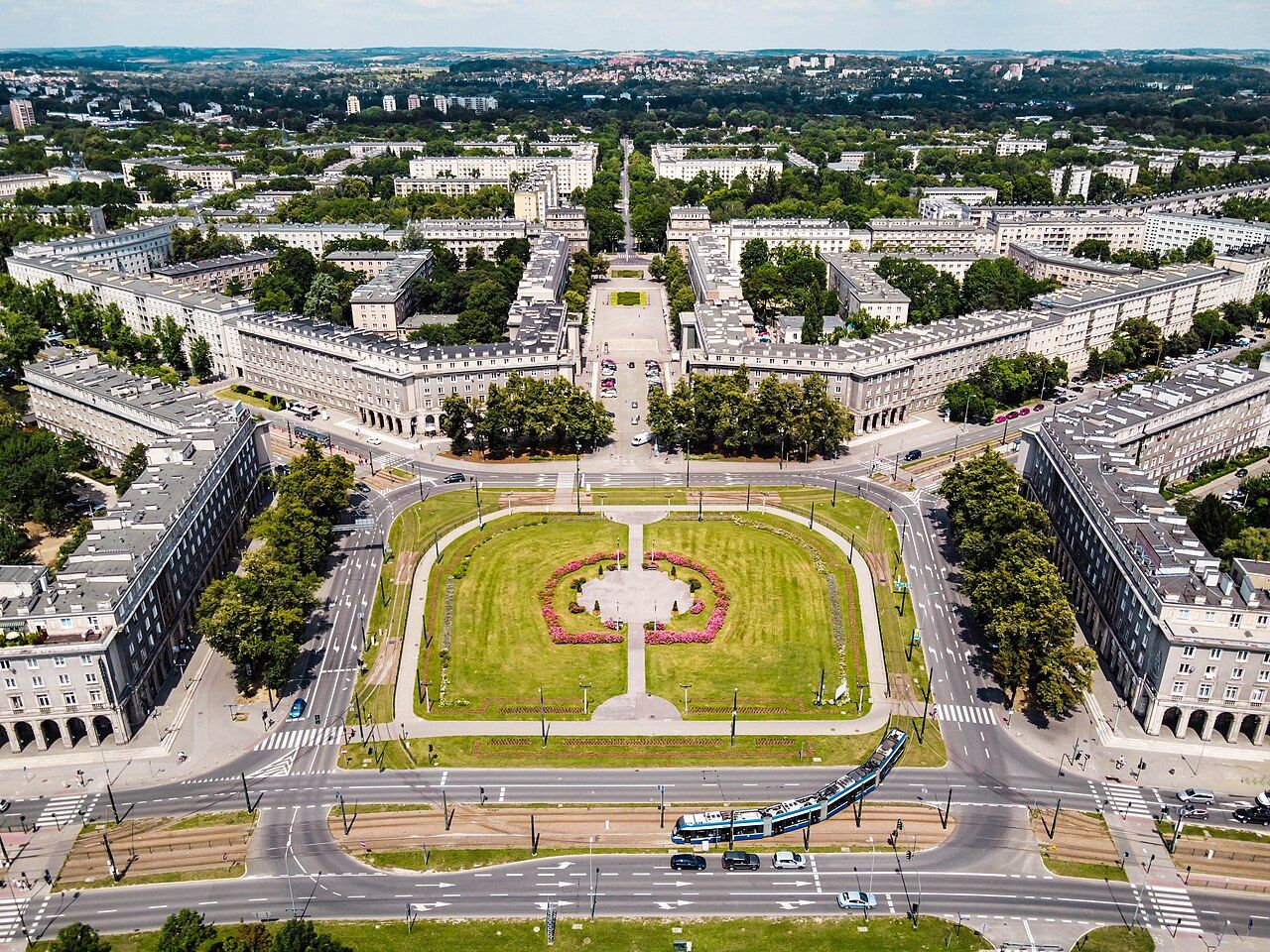
Nowa Huta began as a planned town for steelworkers. At Plac Centralny, its radiating avenues and socialist realist façades make the plan legible.
What was decided in 1949?
The decision to build a new steelworks and a town for its workers east of Kraków was taken in 1949. Nowa Huta began, then, not as an old settlement that grew by degrees, but as a town imagined alongside an industrial project. The distinction matters when I look at its centre. Plac Centralny does not feel like a square that happened to gather streets around it. It is the point from which the town’s main avenues fan out.
A team of architects led by Tadeusz Ptaszycki designed the new town. Nowa Huta became a district of Kraków in 1951. Those facts sit close together in my mind: a plan for a workers’ town, a design team, and then its place within the city. The square gives that history a shape that can be read without needing to turn it into a grand tale.
Why begin at Plac Centralny?
Because the avenues begin here. Their lines spread out across the town, and the square makes their arrangement plain. At Plac Centralny, the plan becomes something that can be read in the streets.
The layout is often compared to plans for Renaissance and Baroque ideal cities. I find that comparison useful as a way of looking, rather than as a label that explains everything. It brings attention to order: a defined centre, avenues set out from it, and buildings that give the centre a carefully composed face. The idea is visible in the arrangement itself, before any details of the façades are noticed.
From the square, those avenues lead out towards the lettered housing estates. The link between centre and surrounding town is part of the design’s meaning. Plac Centralny is not only a place to arrive at; it is also the starting point for lines that continue through Nowa Huta.
What do the façades say?
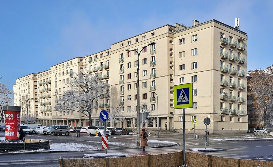
The buildings around Plac Centralny are in socialist realist style. Their arcades, cornices and attics borrow from Renaissance architecture. There is a meeting here between a political style and older architectural forms: the façades give the town’s central idea a recognisable, carefully framed expression.
I tend to notice how the details belong to the larger arrangement. An arcade or cornice is not the whole story; it is part of a group of buildings surrounding the square, and of a plan whose avenues radiate beyond it. The borrowed forms do not erase the socialist realist style. Instead, they make the buildings’ particular combination of references visible.
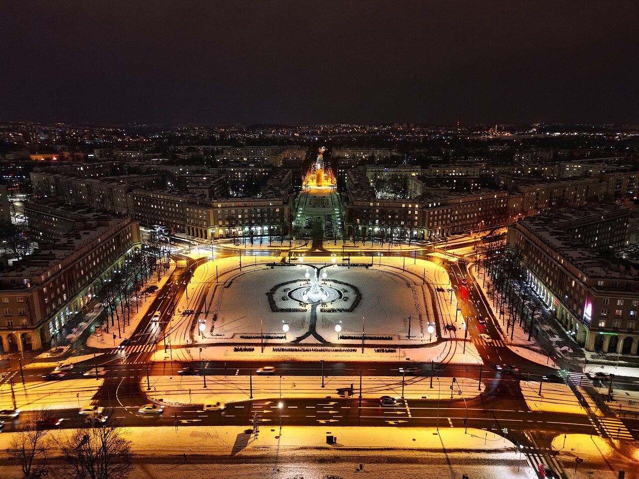
The plan can be read at more than one scale. The view begins with the buildings around Plac Centralny, then widens to include the avenues and the town they cross. I like the way those scales remain connected: the square is a place in its own right, but it also points outwards.
How did the town take shape?
The steelworks and the town were conceived together. The first blast furnace of the steelworks was lit in 1954. I keep that fact beside the square’s geometry, rather than setting them apart: the town was planned for workers, and its principal gathering point and avenues were part of that plan. The political idea is not abstract here. It has a centre and routes leading from it.
There is also a personal feeling in returning, in thought, to a place planned so deliberately. I am drawn to the difference between a design on paper and a town whose avenues now run through everyday life. Nothing in the plan is simply a diagram once it has buildings around it, routes passing through it, and a square that can be stood in. Yet the diagram has not disappeared. It still helps explain why Plac Centralny feels like a beginning, and why the streets seem to take their bearings from it. That is what has stayed with me about Nowa Huta: the idea remains readable, even as the town is more than an idea.
What are the useful details?
- From Rynek: about 35 minutes by tram.
- Town and square: Nowa Huta was planned from 1949; Plac Centralny is the starting point of its main avenues.
Tram lines run by MPK Kraków link Plac Centralny with the city centre.
What changes when the avenues are followed?
Aleja Róż, the Avenue of Roses, runs north from Plac Centralny. Its direction extends the logic of the centre into another named street, while keeping the square as the point of reference. The avenue also carries a particular history: a large statue of Lenin stood there from 1973 until it was removed in December 1989.
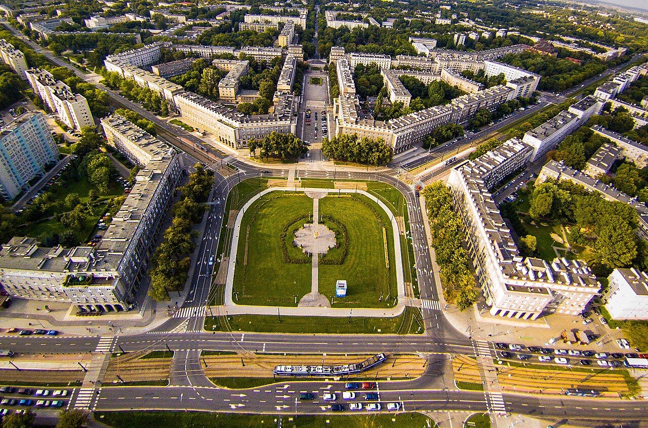
I find that history especially legible against the street plan. The avenue’s name, its direction and the statue’s presence and removal belong to different layers of the place, but they meet along the same route. A plan can organise space; the things placed within it, and later taken away, give that space further meaning.
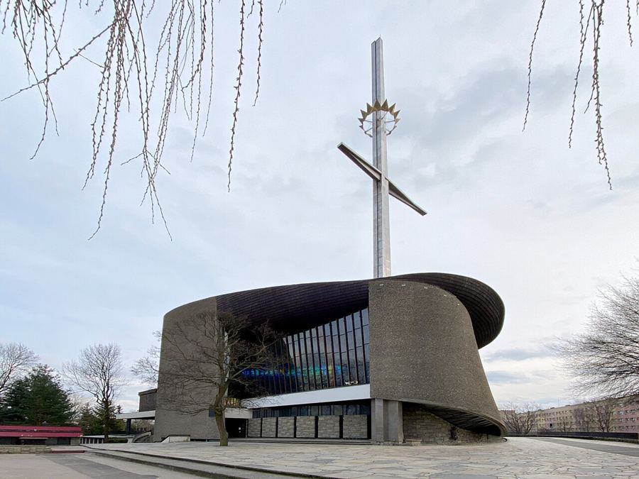
The wider story of Nowa Huta also reaches towards the boat-shaped church of Bieńczyce. It offers another point of connection with the district’s built landscape, beyond the central square and its avenues.
What happened to the square’s name and status?
Plac Centralny was given the additional name of Ronald Reagan in 2004. The urban layout of Nowa Huta was also entered on the register of historic monuments in 2004. Both facts belong to the way the place is named and regarded now, while the plan itself still begins with the square and its avenues.
I return to that starting point when I think about the political idea in the street plan. The centre is clear, the lines spread out, and the façades carry their architectural references. Nothing needs to be added to make the arrangement visible.
What does Plac Centralny leave behind?
For me, it leaves the feeling of a town whose original idea can still be followed through its streets.
At Plac Centralny, the plan becomes something that can be read in the streets.
More from Nowa Huta and beyond
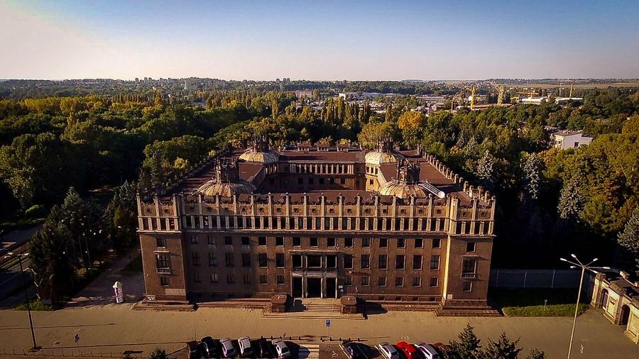 The planned townWhat makes the steelworks’ gate look like a palace?
 The planned townWhat do the courtyards of Nowa Huta still hold?
 A church built by handArka Pana: the church Nowa Huta built by hand
 Old MogiłaThe Cistercians of Mogiła
 Old MogiłaWanda Mound and the white eagle
 MoundsA mound built for Kościuszko
Photographs used: TomRollauer — Creative Commons BY-SA 4.0; Igor123121 — Creative Commons BY-SA 4.0; Minderbinder — Creative Commons BY-SA 4.0; Jacek555 (Jacek Plewa) — Creative Commons BY 3.0; Mateusz Giełczyński — Creative Commons BY-SA 4.0; Pawelsuder — Creative Commons BY-SA 4.0